Justices Reject Legal Challenge to 2001 Roadless Rule

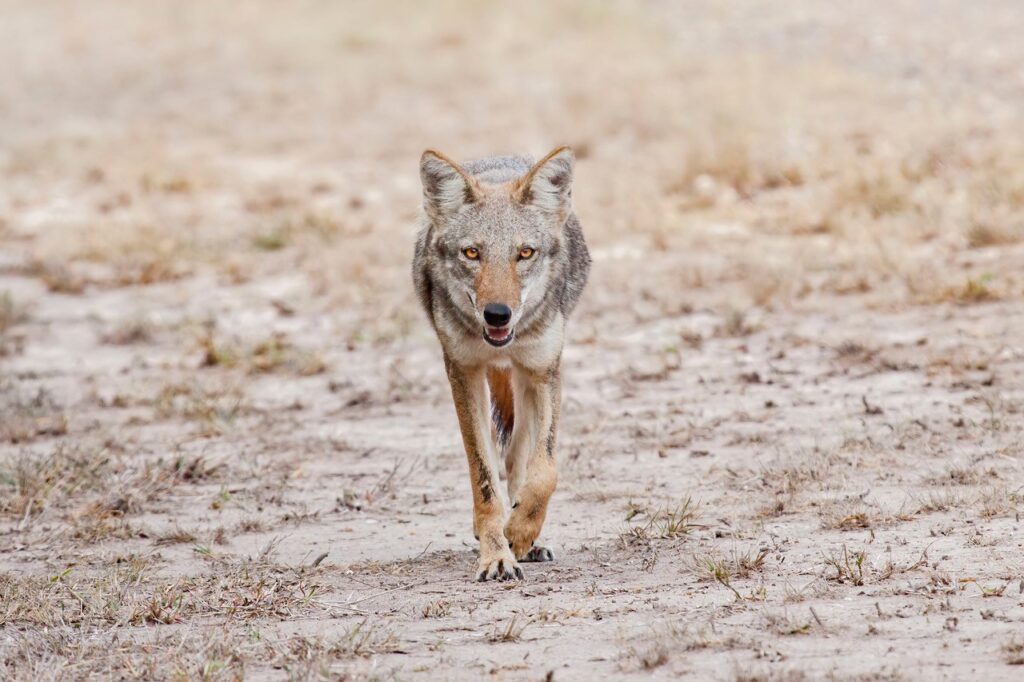
An Inventoried Roadless Area in the San Rafael Mountains, Los Padres National Forest.
Photo © Ron Williams, courtesy of Lighthawk.
Inventoried Roadless Areas represent the last undeveloped, unprotected areas of national forest land in the country. These pristine lands have no roads or development. They provide large blocks of intact habitat for rare wildlife, clean water supplies for local communities, and vast wide-open landscapes for hiking, bicycling, and a host of other recreational pursuits.
But the protection of these roadless areas has been in a state of flux ever since President Clinton issued the Roadless Area Conservation Rule shortly before leaving office in 2001. The so-called “Roadless Rule” protected nearly 60 million acres of national forest land from logging and other development, including more than 600,000 acres in the Los Padres National Forest. It touched off several legal battles, with some courts upholding the Clinton rule and other courts striking it down. The Bush administration repealed the rule in 2005 and replaced it with a state-by-state process that left roadless areas unprotected and was also overturned by the courts.
Earlier this month, the U.S. Supreme Court settled the matter once and for all, rejecting an appeal by the State of Wyoming and the Colorado Mining Association. The challengers had petitioned the nation’s highest Court to overturn the Roadless Rule, arguing that the Roadless Rule violated procedures in the National Environmental Policy Act. The justices’ rejection of the petition effectively ends more than a decade of legal wrangling.
The Roadless Rule prohibits road construction in roadless areas, with some exceptions for public health and safety, existing mineral leases, or for existing rights (for example, to access a private inholding that’s completely surrounded by a roadless area). The rule also prohibits logging in roadless areas, except for small-diameter trees for ecosystem restoration. While not quite as strong as the protections afforded under the Wilderness Act (which prohibits road construction and development in wilderness areas), the Roadless Rule remains as one of our nation’s most powerful tools for the conservation of our national forests.
Local Impact – Roadless Areas in the LPNF
The Los Padres contains 51 roadless areas spanning over 630,000 acres in Ventura, Santa Barbara, San Luis Obispo, Kern, and Monterey counties. The Supreme Court’s decision means that all of these areas will continue to be governed by the Roadless Rule, which generally prohibits road construction and development (with some exceptions).

Roadless areas (varying shades of brown) and Wilderness Areas (dark green) in the Los Padres National Forest. Map courtesy of USFS.
Here are some of the local roadless areas in the Los Padres National Forest:
SANTA BARBARA COUNTY
Mono, Diablo, and Juncal IRAs (Santa Barbara County, 57,214 acres) – These three roadless areas are some of the most wild, unprotected lands in the Los Padres. Stretching from the Santa Ynez River to the Dick Smith Wilderness Area, these lands provide popular hiking, biking, and fishing opportunities, as well as camping at Caliente. Year-round streams support one of the largest populations of threatened California red-legged frogs on the forest.
Fox Mountain IRA (Santa Barbara County, 52,082 acres) – The largest contiguous roadless area on the Los Padres, Fox Mountain overlooks the Cuyama Valley and is known for its exposed rock formations. Lion Canyon was a former release site for endangered California condors, and this area contains a rich assemblage of sites important to Native Americans, including the Sierra Madre Cultural Resource Area.

Fox Mountain is the largest Inventoried Roadless Area in the Los Padres National Forest.
Photo © Ron Williams, courtesy of Lighthawk.
Horseshoe Springs & Miranda Pines IRAs (Santa Barbara County, 30,333 acres) – Just twenty miles east of Santa Maria, the Horseshoe Springs roadless area supports rare animals like the threatened red-legged frog and the California spotted owl. The Bear Canyon Trail cuts through this area and is a popular access point for hikers and mountain bikers.
VENTURA COUNTY
Sespe-Frazier IRA (Ventura County, 31,270 acres) – The Topa Topa Bluffs tower above the community of Ojai and serve as a well-known landmark for this area that stretches from Sespe to Piru creeks. It includes popular trails like Santa Paula Canyon, Potrero John, Middle Sespe, Red Reef, and Pothole.
Nordhoff IRA (Ventura County, 12,024 acres) – Spanning the Nordhoff Ridge, this roadless area provides a source of clean water for the Ojai Valley. Chief Peak offers a scenic overlook of the valley and excellent coastal views beyond. This area is popular with hang gliders, hikers, bicyclists, and horseback riders.
KERN COUNTY
Antimony IRA (Kern County, 40,513 acres) – The Antimony Roadless Area consists of pinon-juniper woodlands and grasslands in the northeastern corner of the Los Padres near Frazier Park. San Emigdio Peak (elev. 7,495′) is the dominant landform, and the area looks out over the San Andreas Fault and the adjacent Wind Wolves Preserve. The area is within the historic range of the California condor, Tule elk, and pronghorn, all of which have been reintroduced nearby. Antimony is popular with hikers and bicyclists alike.
Sawmill-Badlands IRA (Ventura and Kern counties, 51,037 acres) – These nine parcels border the Chumash Wilderness Area, and include the Mt. Pinos summit, where visitors can enjoy views from the Sierras to the Pacific Ocean. This roadless area also includes the Mt. Pinos Botanical Special Interest Area for native plant enthusiasts, and habitat for the endangered California condor.
SAN LUIS OBISPO COUNTY
Machesna Mountain IRA (San Luis Obispo County, 12,245 acres) – These four parcels all border the existing Machesna Mountain Wilderness Area. They’re adjacent to a release site for the endangered California condor, and also contain several Native American heritage sites.
Big Rocks IRA (San Luis Obispo County, 11,841 acres) – The southernmost extent of the Santa Lucia Range, east of Arroyo Grande, is characterized by rolling hills, steep canyons, and large rock outcrops popular with rock climbers. The area also contains several Native American heritage sites and habitat for rare animals like the California red-legged frog and the least Bell’s vireo.
MONTEREY COUNTY
Black Butte IRA (Monterey County, 2,500 acres) – Adjacent to the Ventana Wilderness Area, the largest wilderness area on the Los Padres, Black Butte contains mixed evergreen forests. Piney Creek flows through these parts, providing critical habitat for endangered steelhead.


Comments are closed.