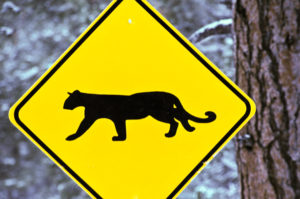
Our region’s wildlife navigates a complex network of interstates, highways, and other roads as they travel across the landscape in search of food and shelter. Each year, more than 7,000 animals are killed or injured by vehicle collisions throughout California. Highways in and around the Los Padres National Forest are hotspots of mortality for animals such as black bears, mountain lions, coyotes, bobcats, foxes, and other unique wildlife species. Until recently, scientists and travel planners knew very little about the extent and location of roadkill. Agencies such as California Highway Patrol, CalTrans, and the California Department of Fish and Wildlife do not officially track roadkill.
Tracking Collisions and Roadkill
In 2010, the UC Davis Road Ecology Center began tracking animal-vehicle collisions throughout the state by developing the California Roadkill Observation System (CROS). This system provides an easy way for anyone to add an observation of roadkill online. As of 2018, over 58,000 observations have been entered into the CROS database.
The Center for Road Ecology has also been working with the California Highway Patrol (CHP) to track wildlife vehicle collisions since 2015. Using the CROS observations and limited CHP data, researchers have been able to estimate accidents involving wildlife throughout the state. In a 2018 report, researchers found that 170 black bears had been involved in a vehicle collision in 2017 alone — nearly twice the number from the previous year. They also found that 64 mountain lions had been struck in 2017, which was 45% more than in 2016.
We encourage you to join this growing network of citizen scientists by reporting any roadkill you see or wildlife collisions you experience to the CROS database. When driving, safely note the location of any wildlife mortality you observe along the road — especially if they are mountain lions, deer, and bears. These larger wildlife are particularly vulnerable to wildlife strikes. Then when you’re off the road and back in front of a screen, you can enter the data and know that you are helping a statewide effort to collect data. The database is being used for ongoing research into collision hotspots and the development of wildlife corridors and crossings. You can report your observation by filling out the easy online form found here:
Record Your Roadkill or Animal Collision Observation
Wildlife Corridors and Crossings
One of the most important steps that should be taken to protect wildlife from vehicle collisions is developing safe wildlife corridors and crossings.
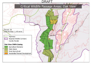
Wildlife corridors establish zones through urban and suburban areas where development is either reduced or carried out in a way that enhances wildlife movement through these human-dominated areas. Corridors are established to connect large swaths of wildlands that have been fragmented by roads, subdivisions, and other forms of development. There is currently a project underway in Ventura County to establish wildlife corridors throughout the county that would connect areas such as the Santa Monica Mountains National Recreation Area to the Los Padres National Forest. These corridors would particularly enable mountain lions to move more freely and safely across the landscape so that populations can mix (which can help avoid inbreeding and make wildlife populations more genetically healthy). Several mountain lions have been killed in southeastern Ventura County in recent years due to vehicle collisions.
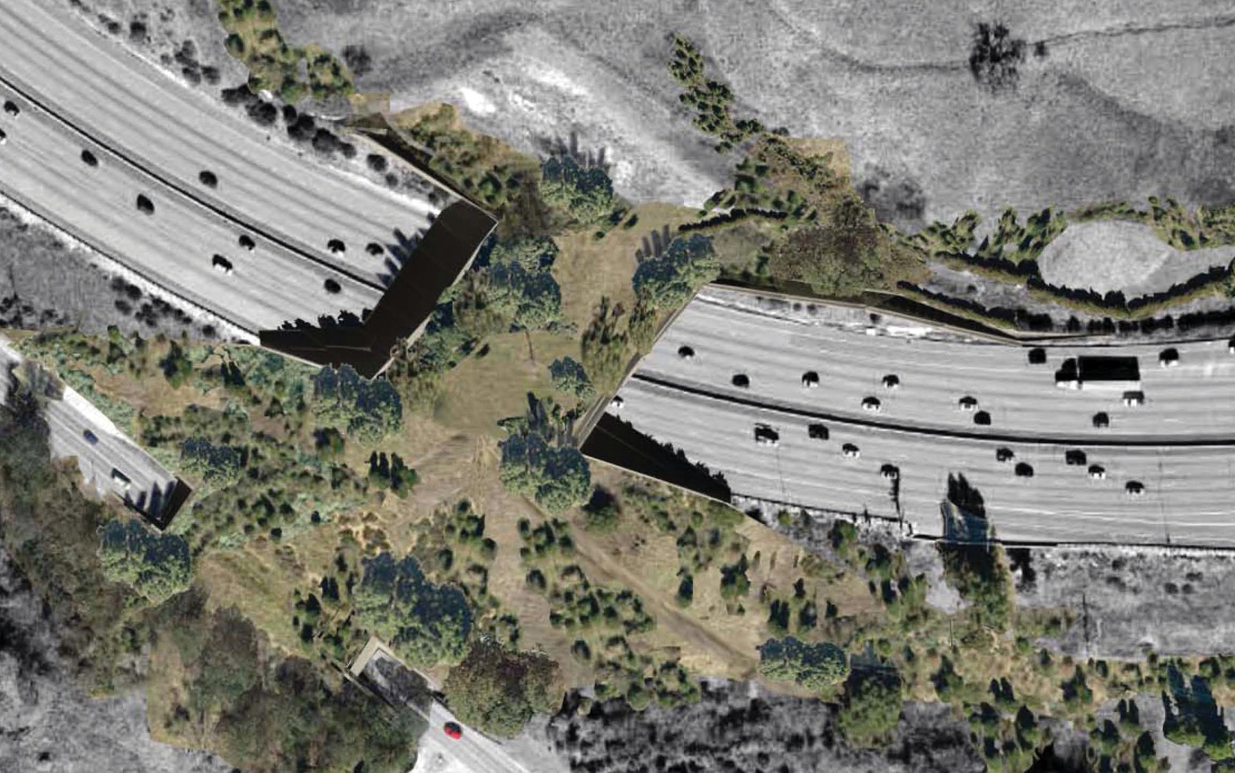
Creating safe wildlife crossings are another key aspect of facilitating the safe movement of animals across the human landscape. These may involve constructing a wildlife tunnel under a major highway or even a wildlife-only bridge over a busy road. One such project is already being planned near Thousand Oaks, where a wildlife overcrossing will be established across Highway 101.
By improving the ways our decision-makers collect wildlife collision data, they will be better-equipped to identify problem areas and prioritize future projects. This, in turn, will give wildlife throughout our region the freedom to roam safely across the landscape.
Be sure to check back on our website for more information about specific projects and how you can support them.