
Santa Barbara, CA — Last week the Forest Service announced a plan to log large trees and clear native chaparral habitat across 235,000 acres (368 square miles) within four of the five ranger districts of Los Padres National Forest. The announcement comes just a few months after conservation organizations, Patagonia, and two municipal governments filed lawsuits against the Forest Service over their approval of logging on Pine Mountain in Ventura County. The new project is 311 times larger and would fundamentally alter the landscape while taking limited funding away from more effective wildfire mitigation efforts such as home hardening and retrofits, community alert systems, and defensible space.
The announcement—signed by Forest Supervisor Chris Stubbs—included a letter and a short description of the new proposal, dubbed the “Ecological Restoration Project,” that was crafted behind closed doors in recent months. The project is likely the largest to ever be proposed for the Los Padres National Forest as it includes 48,000 acres of logging and other vegetation removal across several areas designated as “forest health treatment units” in addition to 186,000 acres of tree and shrub removal along roads, trails, and in many remote parts of the national forest. If approved, the project would allow the same activities the agency is planning on Pine Mountain—activities that were opposed by over 16,000 people, including tribal groups, elected officials, organizations, and businesses across the region—at an enormous scale.

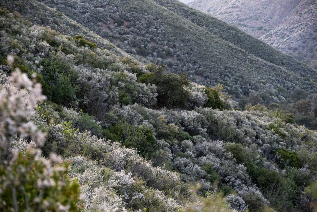
The project would allow the use of heavy equipment to log live and dead trees up to two feet in diameter across many forested areas, and larger trees with no diameter limit could be removed across the 186,000 acres of vaguely described “fuel break and defense zones.” If the project moves forward and receives approval from the agency, damaging timber harvest and chaparral removal activities could take place from Mt. Pinos to Figueroa Mountain to Big Sur without any further site-specific environmental analysis or public notice.
“What the Forest Service is proposing here is truly massive and dangerous,” said ForestWatch director of conservation and research Bryant Baker. “It would facilitate the construction of dozens of ecologically damaging remote fuel breaks that have been shown time and again to fail under the extreme weather conditions that fuel the largest fires in our region.”
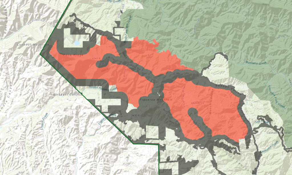
Many areas targeted for clearing are currently being reviewed by Congress for protection as wilderness under the Central Coast Heritage Protection Act, which just passed the U.S. House of Representatives last month and is awaiting a vote in the Senate as part of a larger legislative package. According to analysis of official mapping data obtained from the agency, about 35,000 acres of the new project overlaps with the new land designations.

Forest officials have indicated that they plan to prepare an environmental assessment for the nearly forest-wide project. While this involves more analysis than the loopholes the agency has been using to approve recent logging projects, it still only requires a single public comment period—ongoing until August 28 unless an extension is granted—and is less robust than an environmental impact statement, which is typically prepared for projects of this size and scope. The agency’s funding for the environmental review process comes from a $1.681 million grant from PG&E, a utility that has been responsible for some of the state’s largest and deadliest wildfires including the 2018 Camp Fire that killed 85 people and destroyed nearly 19,000 structures. Because the company’s service area does not cover southern Ventura County, the entire Ojai Ranger District stretching from Pine Mountain Ridge to Ojai has been excluded from the project.
“PG&E is pouring millions into ecologically destructive projects while failing to address their own infrastructure’s deferred maintenance and ignition risk in the area,” said Baker, whose organization has filed requests under the Freedom of Information Act to learn more details about the funding.
For nearly 80% of the project area, there is no diameter limit for tree removal. The proposal states that only “some” trees would be retained in these areas. According to the agency, fuel breaks would be up to 1,500 feet wide depending on the vegetation type, but preliminary analysis of mapping data has revealed that several fuel breaks would be 2,000 to 5,000 feet wide. Researchers have found that fuel breaks are ineffective at limiting the spread of large wildfires, especially under extreme weather conditions such as Santa Ana or sundowner winds. These conditions have been a driving force of some of the region’s largest blazes, such as the 2017 Thomas Fire.
Scientists and conservation organizations have long advocated that instead of going to backcountry logging and vegetation removal projects, funding should be directed to creating defensible space directly next to homes, retrofitting and building structures with fire-safe materials, and reducing development in the wildland-urban interface. Areas where native trees and shrubs are removed with heavy equipment are also prone to being infested with non-native invasive plants that can increase wildfire risk.
The agency is currently accepting public comments on the proposal until August 28. Visit lpfw.org/ERP to easily submit a comment online. An interactive map showing the areas slated for logging and vegetation clearing can be found at lpfw.org/ERP-map.


Comments are closed.