A portion of East Fork Cold Spring Trail in the bottom half of the photo (taken in March). The trail is partially visible, with a large section that has been washed out. This is one of a few trails we recommend avoiding until restoration work can be done. Photo by Ronald L. Williams.
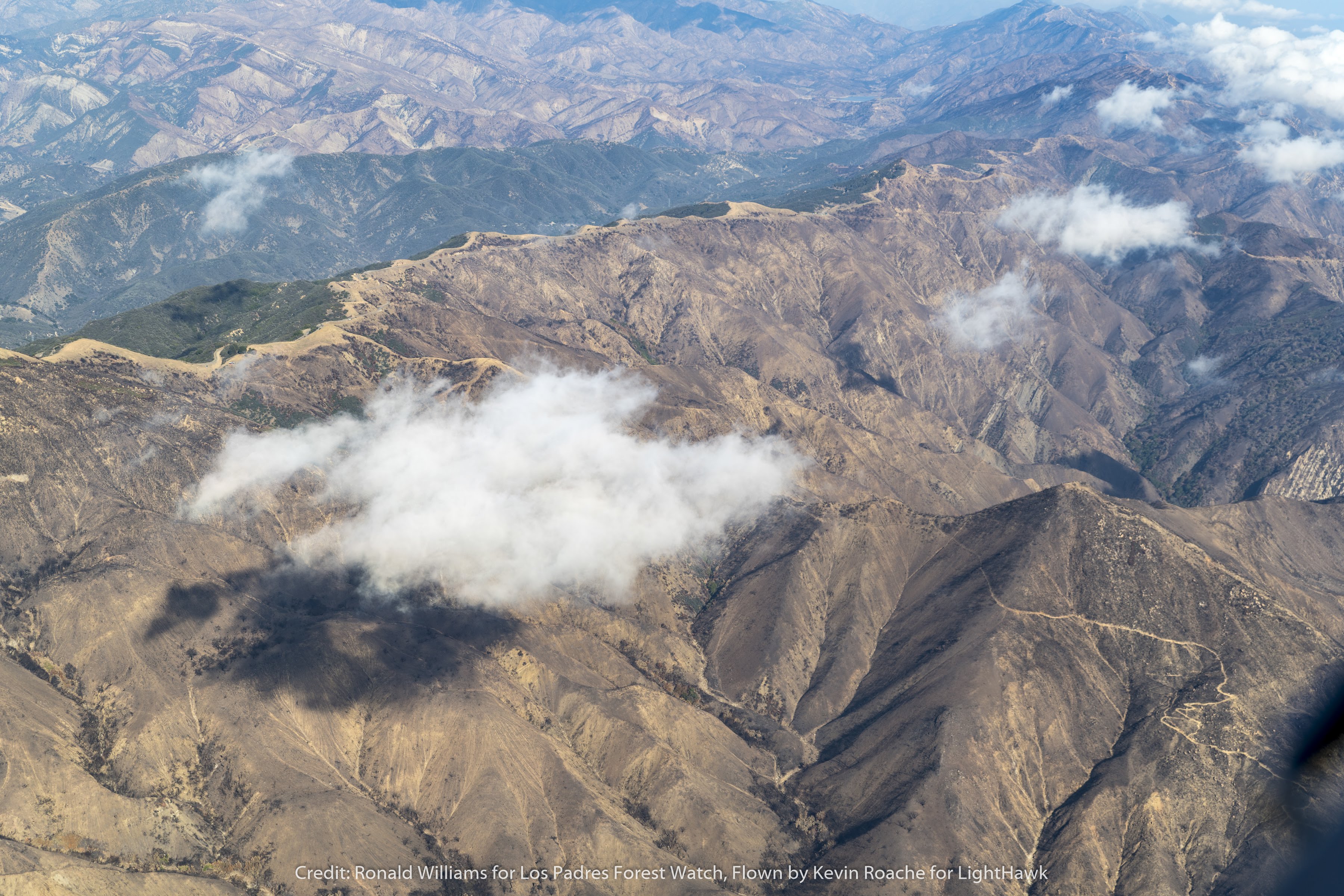
Last week, the Forest Service announced that the closure order for the area burned by the Thomas Fire has been lifted. The area had been closed since December 10 of last year.
So what does this mean for the public? Most areas and trails within the Thomas Fire scar are now open. However, some specific trails and campgrounds remain closed and several trails and areas were heavily damaged in the January rains and debris flows, especially in the Santa Barbara frontcountry. Some trails contain portions that are on Santa Barbara city and county property. Trails in these areas remain closed:
- Cold Spring Canyon Trail (all of West Fork and sections of East Fork)
- Hot Spring Trail (lower section)
- San Ysidro Trail (lower section)
- Buena Vista Trail (lower section)
The Forest Service has also retained the closure of the Divide Peak OHV Trail, Middle Lion Campground, and Rose Valley Campground due to storm and fire damage. These areas will remain closed indefinitely.
We recommend avoiding some of the trails that were impacted by debris flows earlier this year near Santa Barbara and Montecito but are now technically open:
- Cold Spring Trail (sections of East Fork)
- Girard Trail
- Franklin Trail – North and South
- Hot Spring Trail (upper portion)
- McMenemy Trail
- Romero Canyon Trail – South
- San Ysidro Trail (upper section)
These trails have several sections that were mostly washed away and are still unstable. Sections of these trails are also covered in ravel, which can make it difficult to find safe footing while hiking. We have put together an interactive map that you can use to view these trails and other areas affected by the Thomas Fire:
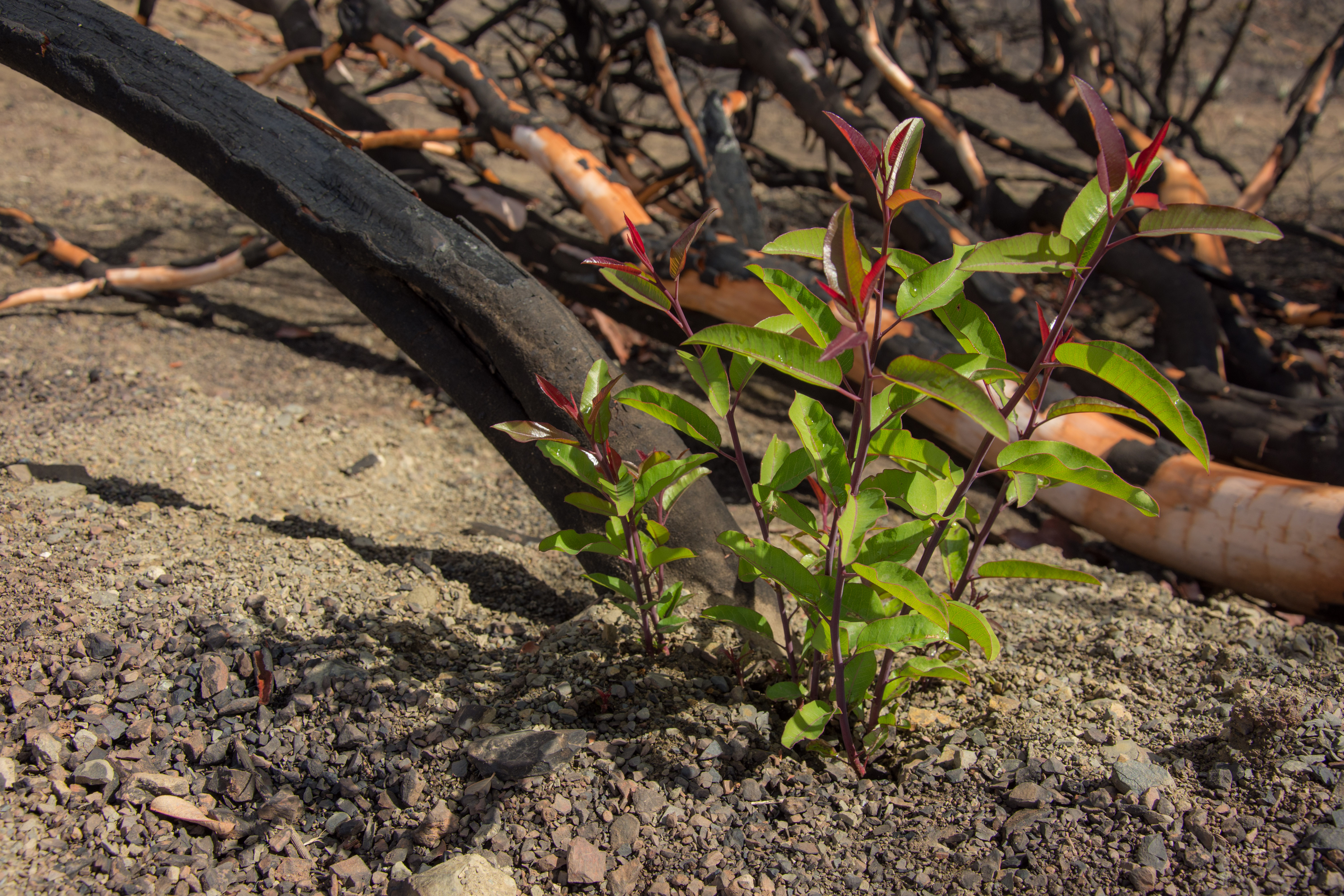
Laurel sumac re-sprouting in Wheeler Gorge.
It is also important to note that the re-vegetation process is one best left to nature. Seeding the areas burned during the Thomas Fire is unnecessary as the soils in the burn area already contain a robust seedbank comprised of local species, and seeding efforts may actually do more harm than good. Our region has an incredible diversity of plant species, some of which may only be found in certain canyons or along particular ridgelines. Species that are native to the state or the region may not naturally occur in various areas that were burned, and seeding with such species can cause unnecessary competition that can change the natural species assemblage over time.
To help the area recover, we will be organizing invasive plant removal efforts throughout the burn area as the vegetation comes back. This is a better approach to assisting the area’s recovery, as the exposed soil in many areas will be susceptible to invasive species spread over the coming years. Removing these invasive species before they can become established will improve the recovery of native species and the overall ecosystem’s functioning. Another key to helping the area recover is to prevent fires from occurring across the vast Thomas Fire scar within the next few decades. You can read more about chaparral fire ecology here.


Comments are closed.