In November of last year, Interior Secretary Deb Haaland—the first Native American in that position—issued Secretarial Order 3404, which formally designated the term “squaw” as derogatory and created a federal task force dedicated to finding official place names or geographic features on federal lands that include the word. This Derogatory Geographic Names Task Force identified about 660 place names on federal lands across the country that contain the term, including three in the Los Padres National Forest. The agency is accepting suggestions for renaming these places and features until April 25, and we have been working with local Indigenous leaders to submit ideas for new names.
“Racist terms have no place in our vernacular or on our federal lands. Our nation’s lands and waters should be places to celebrate the outdoors and our shared cultural heritage—not to perpetuate the legacies of oppression.”
– Interior Secretary Deb Haaland
More recently Secretary Haaland announced that the Department of Interior would be referring to the word in communications as “sq___” going forward, which is a policy that ForestWatch has adopted as well.
The word sq___ has roots in Algonquian languages in the Northeast, but it has been twisted by Euro-Americans into a derogatory term used against Indigenous women, particularly over the last 150 years or so. Efforts to rename geographic features to rid them of racist language is part of a broader movement to retire offensive mascots, logos, and symbols as well as to reconcile the often fraught history of public lands in the United States. A famous ski town in the Sierra Nevada, Sq___ Valley, recently decided to change its name to Palisades Tahoe. And in 1995, the state of Minnesota made it illegal to use sq___ in place names, with six other states following suit since then.
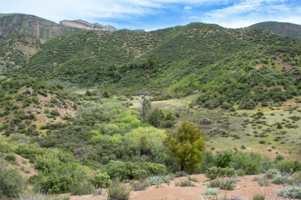
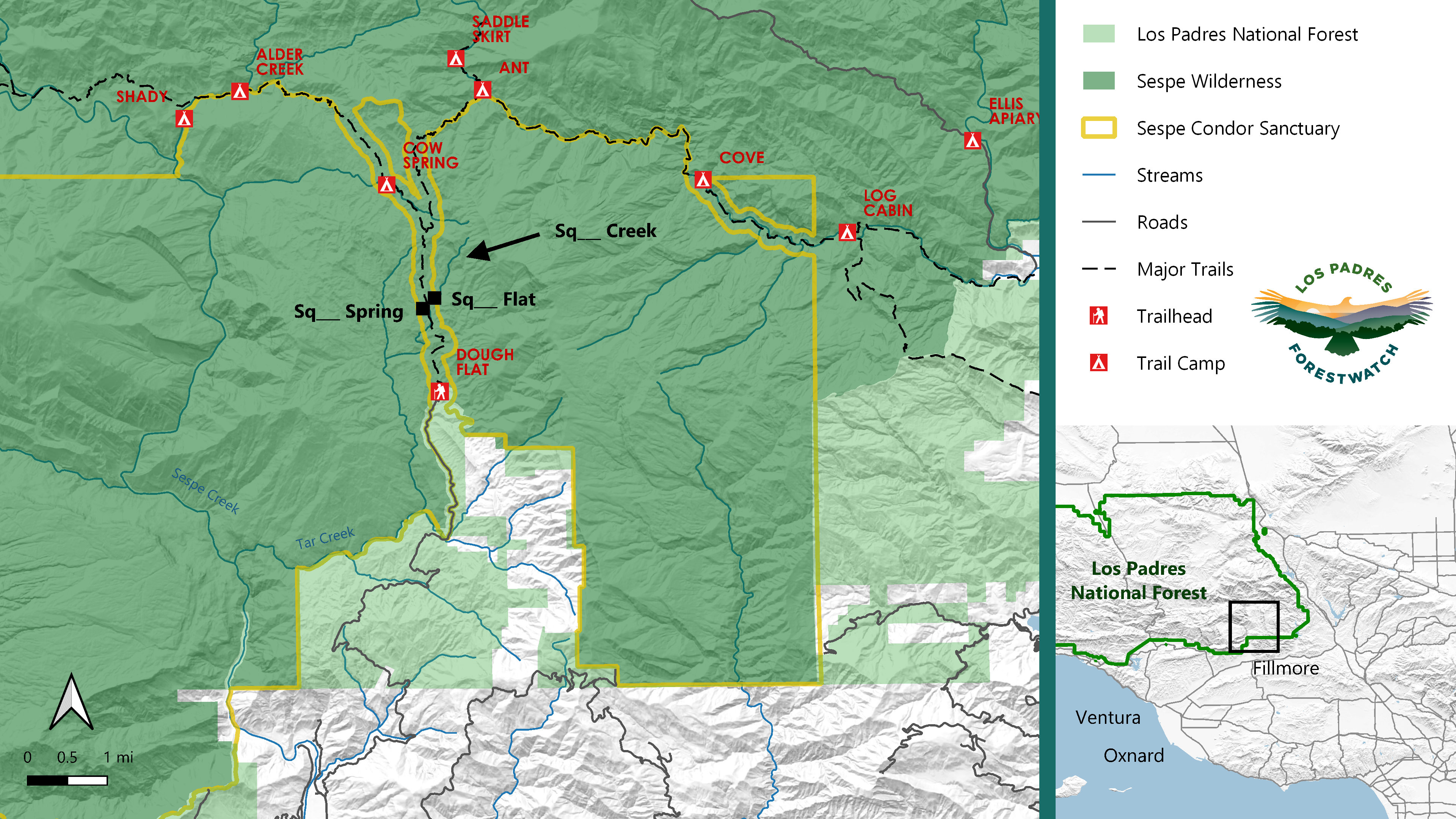
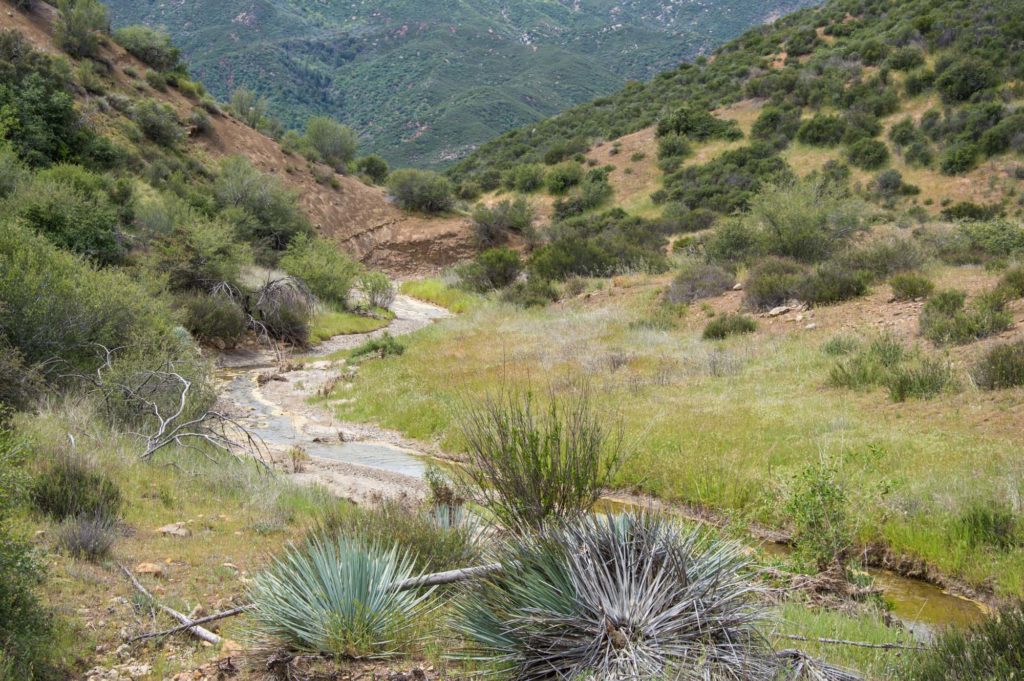
The three place names identified in the Los Padres National Forest are Sq___ Flat, Sq___ Creek, and Sq___ Spring. They are all within an area about 125 acres in size in the Sespe Wilderness north of Fillmore. The creek is relatively small, but it flows into Redrock Creek which flows into Tar Creek, a major tributary to Sespe Creek. Anyone who has hiked along Alder Creek Trail from Dough Flat Trailhead has likely walked right past all three geographic features. To get to that trailhead, one must drive on Sq___ Flat Road. The renaming of Forest Service and County roads will be addressed through a separate process.
It is unclear exactly when these names came into use in the area, but Sq___ Flat was labeled as such on the earliest topographic map we could find for the area (1903) while Sq___ Spring did not appear on a map until the 1940s. After looking through every official topo map for the area, the earliest we could find Sq___ Creek was in 1991, suggesting that this creek was named rather recently.
During the early decades of the 1900s, Sq___ Flat was the site of some of the northernmost drilling operations in the Sespe Oil Field. These efforts were unsuccessful, and the oil company ultimately abandoned the site along with equipment such as tanks, a boiler, and even a large steel tower that has since fallen. Over the past few years, ForestWatch has worked with volunteers to remove most of the abandoned tanks while only using tools that comply with the Wilderness Act, including pack mules. There is still more work to be done, and our efforts so far are just a small step in the direction of removing remnants of past American industrial exploitation on this landscape that has long been important and utilized by the Chumash.
Removing the term sq___ is only the beginning phase of a larger effort by the Biden Administration to remove racist language from public lands. The move is not without precedent in the Los Padres National Forest. Cerro Noreste, a mountain near Mt. Pinos, was unofficially named Mt. Abel for several decades before being renamed to its current name (which means Northwest Mountain in Spanish). The unofficial name referred to Stanley Abel, a longtime Kern County supervisor and avowed as well as outspoken member of the KKK. In 1988 the USGS Board on Geographic Names voted to reaffirm that Cerro Noroeste was and remains the only official name of the mountain. And a stream in the Monterey Ranger District was once called the N-word Fork of the Nacimiento River. We are still investigating this case, but so far we’ve found that it was included on official topo maps until 1968 when an official map suddenly denoted the stream as the Negro Fork of the Nacimiento River. This may have been quietly changed, which was likely common during the midcentury Civil Rights Movement. However, this change did not go far enough considering the former name.
We look forward to helping identify other places and geographic features with derogatory terms as part of a continued push to acknowledge past wrongs and make public lands more welcoming for all.


Comments are closed.