A Missed Opportunity?
Sixteen Inventoried Roadless Areas (IRAs) across the Los Padres National Forest were included in the Forest Service’s recently-released draft Supplemental Environmental Impact Statement. The Forest Service prefers an option that would largely assign these IRAs the less stringent Back Country Non-Motorized (BCNM) designation. But oil exploration and drilling, mining, radio towers, and other energy development are all allowed on BCNM lands, as is land disposal to private interests.
Areas recommended for wilderness designation are protected from those perils. Read below to learn more about these IRAs and ForestWatch’s concerns for each area.
Santa Barbara County
Cuyama Inventoried Roadless Area (19,641 acres)
Mount Pinos Ranger District
The Cuyama Inventoried Roadless Area is covered largely by desert chaparral and pinyon.
Cuyama Peak provides scenic views toward the Cuyama Valley, and a point from which – with some luck – one can view the endangered California condor. Cuyama Peak is also one of the few remaining lookout sites, though both the lookout cabin and the 1940s-era AWS (Aircraft Warning Service) residence cabin below have collapsed in recent years and lay in ruins. The area is popular with hunters and hearty day hikers. A maintained dirt road takes motorized travelers to the top of Cuyama Peak, and lies outside the area being proposed for Recommended Wilderness. There are no maintained trails in the IRA.
The Cuyama IRA — home to the endangered blunt-nosed leopard lizard — is within a High Oil and Gas Potential Area, and is threatened by current and proposed oil development activities.
Diablo Inventoried Roadless Area (19,608 acres)
Santa Barbara Ranger District
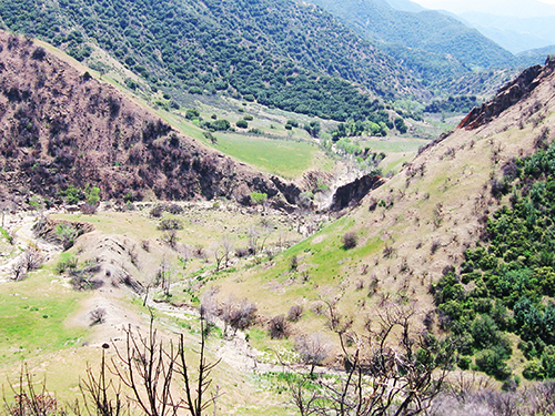
Image courtesy Marc Briggs
Bordered on three sides by Forest Service administrative roads and dominated by the Agua Caliente and Diablo watersheds, this IRA is home to bear, deer, lion, and numerous smaller wildlife. Chaparral and riparian habitat are the dominant landscapes.
The historic but largely unmaintained (Agua) Caliente trail is within this IRA, and there are a handful of archaeological sites, including Chumash rock art sites, across the IRA. The Upper Caliente trail camp is also within this unit.
The IRA supports the federally threatened California red-legged frog, federally endangered arroyo toad, the rare Pacific pond turtle, and the two-striped garter snake. The federally endangered least Bell’s vireo and its critical habitat are also found in this unit. Without a Recommended Wilderness Designation, the area remains subject to oil drilling, mining, logging, construction of communication facilities, wind energy development, and land sale, though no such proposals are currently pending at this time.
Fox Mountain Inventoried Roadless Area (52,109 acres)
Mount Pinos and Santa Lucia Ranger Districts
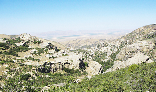
Image courtesy Jonathan M. McCabe
Blanketed by chaparral, sage, and pinyon but with a sizeable hardwood area, the Fox Mountain IRA occupies the northern slopes of the Sierra Madre and drainages leading to the Cuyama River. Notable among these drainages is Lion Canyon, location of one of the first condor release sites, and a geologic marvel with massive sandstone outcrops.
The IRA also features nearly 20 miles of trail, two of which (the Bull Ridge and Rock Ridge routes) have lost their northern trailhead due to access issues along Perkins Road. There are several spotted owl territories in this roadless area, unique red rock formations, remnants of ancient petrified forests and other paleontological artifacts, and several rare plants and animals. Grassy meadows known as “potreros” characterize the upper elevations, and an abundance of natural springs provide sources of clean water. Visitors to this area enjoy remarkable views in all directions, from the Carrizo Plain to the southern Sierra Nevada range. Most of the area is visible from remote Highway 166 and Highway 33, the latter of which is a California Scenic Highway and a National Forest Scenic Byway.
Perhaps most significantly, the Fox Mountain unit contains one of the country’s largest assemblages of Native American rock art, including the Eastern Sierra Madre Ridge Archaeological District that is listed in the National Register of Historic Places. The area is threatened by an extensive network of abandoned roads from historic oil drilling activities, and is also vulnerable to future oil development. It is within a High Oil and Gas Potential Area.
Juncal Inventoried Roadless Area (12,295 acres)
Santa Barbara Ranger District
Dominated by steep terrain, sandstone outcrops, the Juncal IRA is blanketed by heavy chaparral of the Juncal and upper Santa Ynez watersheds.
The challenging terrain offers daytrip opportunities for hearty backcountry explorers, and is popular with hunters.
The IRA is home to a handful of threatened flora species, and abuts the Santa Ynez River at a critical habitat area for the threatened California red-legged frog. This area also contains the headwaters of several streams that feed Jameson Lake, one of the key freshwater sources for southern Santa Barbara County. There are numerous highly significant archaeological sites, including Chumash rock art sites, across the IRA. Without a Recommended Wilderness Designation, the area remains subject to oil drilling, mining, logging, construction of communication facilities, wind energy development, and land sale, though no such proposals are currently pending at this time.
Madulce Buckhorn Inventoried Roadless Area (14,186 acres)
Santa Barbara and Mount Pinos Ranger Districts
The Madulce Buckhorn IRA supports a high degree of biodiversity and consists of two non-contiguous parcels separated by the existing Dick Smith Wilderness. Once featuring heavy stands of conifers, post-Zaca Fire (2007), the area is now in the early years of a decades-long recovery. Approximately 2,881 acres of the IRA has already been zoned as Recommended Wilderness in the Los Padres National Forest Land Management Plan. Both a portion of the Mono Basin Special Interest Area and the Indian Creek Critical Biological Land Use Zone, where scientific studies of the many plant and wildlife species are ongoing, are within this unit. The lower stretch of Indian Creek supports numerous endangered and threatened species, including the arroyo toad and California red-legged frog. Portions of the area are available for oil and gas leasing, and part of the area is identified as having high potential.
The Buckhorn Trail is part of a popular backcountry loop for mountain bicyclists. For this reason, LPFW and other wilderness advocates are recommending that this trail, and areas to the south, be zoned Back Country Non-Motorized (and not Recommended Wilderness) so that this popular trail remains open for mountain bike use.
The area is threatened by oil development, and certain sections are classified as having “high potential” for oil deposits.
Spoor Canyon Inventoried Roadless Area (13,776 acres)
Santa Lucia Ranger District
A narrow stretch of steep drainages along the northernmost roadless area of the Sierra Madre Range, the Spoor Canyon IRA is home to a small population of California spotted owl. Four rare plant species are known to occur within the IRA: San Luis Obispo mariposa lily, Blakley’s spineflower, umbrella larkspur, and Parish’s checkerbloom.
Sierra Madre Road forms the southern boundary of the IRA, but there is no formal recreational access in this area.
The area has a “high potential” for future oil development, according to the U.S. Forest Service.
Tequepis Inventoried Roadless Area (9,089 acres)
Santa Barbara Ranger District
Image courtesy Craig R. Carey
The popular hiking and mountain biking Tequepis Trail climbs from Circle V Ranch to the West Camino Cielo. For this reason, ForestWatch and other wilderness advocates are recommending that this area be protected through a Back Country Non-Motorized designation, which would allow mountain biking to continue along this popular route. A historic oil well was located in this area, and it is also vulnerable to illegal off-road vehicle trespass along West Camino Cielo Road. Without the protections afforded by a Recommended Wilderness designation, the area is in dire need of a management plan and strict guidelines to protect the area from these damaging activities.
The IRA provides habitat for rare species like the California spotted owl and steelhead trout. Use of this area by the endangered California condor is expected to increase as their numbers grow to recovery level. Five rare plant species are known to occur within the unit, including many that are not found outside of this immediate region: Refugio manzanita, late-flowering mariposa lily, umbrella larkspur, Ojai fritillary, and Santa Ynez false lupine.
Ventura and Kern Counties
Antimony Inventoried Roadless Area (40,513 acres)
Mount Pinos Ranger District
Image courtesy John Brew
Here, the southern slopes of the San Emigdio Mountains rise to an elevation of 7,495 feet, providing a scenic backdrop to Frazier Park, Pine Mountain Club, and other mountain communities in Kern County. It is dominated by the region’s pinyon woodland and Great Basin sage. This area borders the 95,000-acre Wind Wolves Preserve, the largest privately-owned nature reserve on the West Coast.
Though frequented primarily by OHV enthusiasts, the IRA is also popular with day hikers for its numerous cross-country and peakbagging opportunities (there are no maintained trails). The Valle Vista Campground lies just outside this roadless area, and is an excellent spot to view California condors soaring across the landscape.
With the condor release facility at Bitter Creek National Wildlife Refuge to the west of the unit, Antimony remains part of the California condor’s historic range, and is a key roosting and travel area for the great endangered bird. Condors often roost on Brush and San Emigdio Peaks. The Antimony is also home to pronghorn, Tule elk, mule deer, mountain lion, and black bear as well as numerous small wildlife species and a small population of pale-yellow tidytips, which is considered “seriously threatened” in California. Numerous highly significant Chumash rock art sites are found across the IRA. A 2008 peer-reviewed study identified the San Emigdio Mountains as a genetic “hot spot” for wildlife in southern California, due to the convergence of several faults and mountain ranges in the area that contribute to the area’s biological richness. The area is threatened by illegal off-road vehicle trespass, and has a “high potential” for gravel, stone, and mineral extraction and a “moderate” potential for oil development. Off-road vehicle encroachment into the neighboring Wind Wolves Preserve, and wildlife poaching, continues to be a problem. The area has also been targeted by wind turbine construction, which could be incompatible with the area’s use as a prime flyway for condors.
Dry Lakes Inventoried Roadless Area (17,048 acres)
Ojai Ranger District
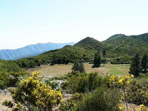
Image courtesy Craig R. Carey
The main component of the Dry Lakes IRA is the Dry Lakes Special Interest Area, which was established for its outstanding botanical values and preserves remnant stands of ponderosa pine along with several relict plant species.
Bisected by the Ortega OHV Trail, the IRA features the historic and abandoned Dry Lakes trail and Dry Lakes West campsite. The Matilija Escarpment — a massive exposed sandstone feature — dominates northerly views along Highway 33 between Ojai and Rose Valley. The area is a popular day hike destination.
Without a Recommended Wilderness Designation, the area remains subject to oil drilling, mining, logging, construction of communication facilities, wind energy development, and land sale, though no such proposals are currently pending at this time.
Quatal Inventoried Roadless Area (7,255 acres)
Mount Pinos Ranger District
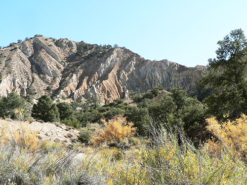
Image courtesy Craig R. Carey
Blanketed by pinyon and juniper woodlands, the Quatal IRA is marked by dramatic eroded canyons for which the San Emigdio Mesa is known.
Many of the canyons are noted for their Miocene-era vertebrate fossils and are a draw for day hikers and amateur geologists alike, though there are no maintained trails in the IRA proper.
Rare plant species are found throughout the unit. The area is threatened by illegal off-road vehicle trespass.
Sawmill Badlands Inventoried Roadless Area (51,376 acres)
Mount Pinos Ranger District
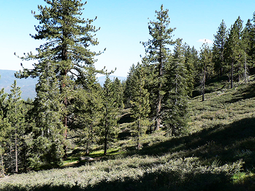
Image courtesy Craig R. Carey
The Sawmill Badlands IRA, consisting of six non-contiguous sections surrounding the existing Chumash Wilderness, is dominated by pinyon and Great Basin sage in the lower elevations and conifer stands in the higher elevations, and is a historically significant region in Chumash lore and life.
Dramatic eroded canyons characterize the popular cross-country hiking and skiing area, with soils ranging from deep red to brilliant orange and white – creating a geologically-unique landscape found nowhere else in the Los Padres National Forest. The area likely contains habitat for the federally-threatened Kern primrose sphinx moth, and the federally-endangered Kern mallow. The Upper Cuyama River Area of High Ecological Significance also overlaps with this area.
The area is primarily threatened by proposals to construct a new off-road vehicle trail that would bisect the western (largest) section of this IRA. It is also vulnerable to mining of gypsum, gravel, stone, and minerals, along with a high potential for oil and gas development.
Sespe-Frazier Inventoried Roadless Area (108,916 acres)
Ojai and Mount Pinos Ranger Districts
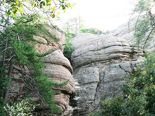
Image courtesy Craig R. Carey
The Sespe-Frazier IRA was a very large roadless area divided into two sections upon the creation of the Sespe Wilderness in 1992. Terrain varies from high-elevation conifer stands to lower riparian areas, with chaparral the most dominant. Piru Creek is a critical habitat for the endangered arroyo toad and steelhead, and several rare species can be found in the unit.
Well over a dozen trails run partially or wholly within the non-wilderness section of the unit, and trail camps in the Ojai RD’s half include West Fork Lion Canyon, White Ledge, Big Cone, Cross, Cienega, and Bluff . Numerous OHV routes, service roads, and “cherry stems” span the unit. OHV trespassing is a concern, particularly in Grade Valley and in the lands abutting the Hungry Valley SVRA.
Mining claims still exist (esp. along Piru Creek), and the potential for mineral location remains high. Ten rare plant species are found in the unit, and a 2008 peer-reviewed study identified the Frazier Mountain area as a genetic “hot spot” for wildlife in southern California.
There are numerous highly significant archaeological sites, including Chumash rock art sites, across the IRA.
The area is threatened by mining and several pending proposals to drill for oil. Moreover, off-road vehicle trespass is common in the area.
White Ledge Inventoried Roadless Area (18,640 acres)
Ojai and Santa Barbara Ranger Districts
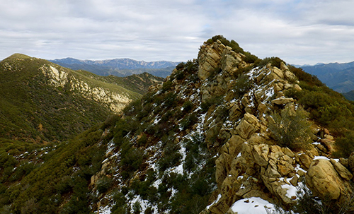
Image courtesy David Stillman
With the namesake 4,840’ White Ledge Peak looming over outstanding views of the Central Coast, the White Ledge IRA is a rugged stretch of the San Rafael-Topatopa subsection of the Transverse Ranges. The steep drainages on both the north and south slopes are dominated by chaparral punctuated with prominent sandstone outcrops. The area’s creeks feed into Lake Casitas, a municipal and agricultural water source for Ventura County.
The IRA includes numerous historical routes (including the Franklin, Steer Creek, Rincon, and Ocean View trails), none of which are actively maintained by the Forest Service but some of which are the focus of volunteer efforts, notably the Franklin and Ocean View routes. These old routes provide opportunity for hearty backcountry explorers.
The California condor frequents this area, making westward forays from the Hopper Mountain Condor Refuge. The California spotted owl has been found in some of the densely canopied riparian areas along the south side of the unit, and the area includes critical habitat for endangered southern steelhead. Further, four rare plant species are known to occur within the unit: late-flowering mariposa lily, umbrella larkspur, Ojai fritillary, and southern jewelflower. The area has been threatened by proposals to conduct uranium mining. In addition, the southern portions of White Ledge have been rated as having a “high potential” for oil and gas development, according to the U.S. Forest Service. A Recommended Wilderness designation would ensure that the area’s pristine landscape is permanently protected.
San Luis Obispo County
Black Mountain Inventoried Roadless Area (16,830 acres)
Santa Lucia Ranger District
Image courtesy Valerie Norton
Blanketed by chaparral, the Black Mountain IRA is home to black-tailed deer, mountain lion, black bear, bobcat, coyote, and numerous bird, reptile, and amphibian species. The Black Mountain Wild Horse Territory (partially within this IRA) supports a herd of approximately 20 horses.
Three non-motorized trails — the Wilson Canyon Trail, Black Mountain Trail, and Fernandez Trail — are located entirely with this unit.
The vulnerable Pacific pond turtle inhabits Navajo Creek. The IRA is also home to four rare plant species (the Santa Margarita manzanita, dwarf western rosinweed, straight-awned spineflower, and yellow-flowered eriastrum), and contains possible habitat for a small flowering plant called the Camatta Canyon amole that is found nowhere else in the world. The area is threatened by unauthorized livestock grazing and a proliferation of unpermitted roads.
Garcia Mountain Inventoried Roadless Area (7,848 acres)
Santa Lucia Ranger District
The Garcia Mountain IRA consists of three separate sections adjacent to the existing Garcia Wilderness and is dominated by chaparral. The Pine Ridge area is well-known for its broken sandstone formations, featuring numerous cliffs, crevices, and caves. It also contains one of the southernmost stands of blue oak woodlands, which is experiencing declines throughout California due to poor regeneration.
The 9-mile Trout Creek trail is contained within this unit. Access to Stony Creek is currently restricted by private landholders.
The area is classified as having moderate oil development potential.
Machesna Mountain Inventoried Roadless Area (12,288 acres)
Santa Lucia Ranger District
The Machesna Mountain IRA consists of four separate parcels adjacent to the existing Machesna Mountain Wilderness, and is dominated by the largely chaparral-covered La Panza Range.
Portions of the Castle Crags and American Canyon trails are within this IRA, as is the 14-unit American Canyon campground. LPFW and other wilderness advocates are recommending that this campground be excluded from a Recommended Wilderness designation, so that it remains opened to motorized access.
Five rare plant species are known to occur within the unit: Santa Margarita manzanita, Palmer’s mariposa, San Luis Obispo mariposa lily, umbrella larkspur and Parish’s checkerbloom.


Comments are closed.