|
July 10, 2008
LOS PADRES ABLAZE
Three
Wildfires Burn More Than 150,000 Acres of
National Forest and Surrounding Land
Fire season
started with a fury this year in the Los Padres National Forest.
On June 8, an escaped campfire in the Monterey Ranger District
started the Indians Fire, which is now 100% contained after
burning more than 81,000 acres of the Ventana Wilderness and
surrounding lands. Two weeks later, lightning strikes near Big
Sur ignited two additional fires - the Basin Fire and the
Gallery Fire - which have since merged into one large fire
called the Basin Complex fire, now at more than 90,000 acres and
only 41% contained.

With
resources already stretched thin by more than 300 fires burning
in the State of California, another fire was reported on July 1
in the front country of the Santa Ynez Range above Goleta.
Firefighters have gained the upper hand on this 9,500-acre
blaze.
These fires
have forced thousands of residents to evacuate, destroyed 29
homes, closed more than thirty miles of Highway 1, and even
prompted a rescue operation of several endangered California
condors by the U.S. Coast Guard. With weather cooperating,
firefighters seem to be gaining the upper hand, and while
conditions can change on a moment's notice, one thing's for
certain - it's going to be a long fire season in the Los Padres
National Forest and throughout the state.
INDIANS FIRE & BASIN COMPLEX FIRE (Monterey County)
On June 8, an
escaped campfire at Escondido Camp along the Arroyo Seco River
started the official fire season with a bang, quickly spreading
into the rugged and remote Ventana Wilderness and the adjacent
wildlands at Fort Hunter Liggett. The fire - now 100% contained
- has burned a total of 81,378 acres, from the Arroyo Seco River
on the west to Reliz Canyon on the east.
 Two
weeks after the Indians Fire started, a freak lightning storm
hit much of northern California, and several strikes near Big
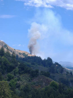
Sur started two separate fires - the Gallery Fire along the
coast (pictured right, shortly after the storm passed), and the
Basin Fire inside the remote Ventana Wilderness. These two fires
have since merged into one and have consumed more than 90,000
acres with 41% containment. Firefighters hope to have the Basin
Fire fully contained by July 30. Two
weeks after the Indians Fire started, a freak lightning storm
hit much of northern California, and several strikes near Big
Sur started two separate fires - the Gallery Fire along the
coast (pictured right, shortly after the storm passed), and the
Basin Fire inside the remote Ventana Wilderness. These two fires
have since merged into one and have consumed more than 90,000
acres with 41% containment. Firefighters hope to have the Basin
Fire fully contained by July 30.
The Basin
Fire has prompted the closure of a 30-mile stretch of the famed
Highway 1 and, after the fire jumped containment lines, an
evacuation of the entire Big Sur community was ordered. It has
destroyed 27 residences and 31 outbuildings. The flames are
being fueled by high temperatures and erratic winds, as well as
tens of thousands of dead oaks that have succumbed to a disease
called sudden oak death. The Basin Complex has cost more than
$31 million, and is poised to merge with the Indians Fire soon.
The Basin fire is also headed towards the remote Tassajara Zen
Mountain Center deep in the Ventana Wilderness, and the monks
there were recently ordered to evacuate.

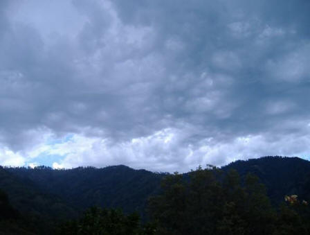
A thunderstorm gathers
above the Ventana Wilderness, causing two fires.
Basin Fire photos © Jennifer Stevens
Thankfully,
all but one of the 25 condors in the wild in the Big Sur area
are accounted for, including two chicks that were nesting in the
burn area. The fate of a third chick, nesting in the cavity of a
redwood tree, remains unknown. The fire has also affected a
condor release site administered by the Ventana Wildlife
Society, burning the condor release pens and an office building.
A U.S. Coast Guard helicopter rescued the eight condors housed
in the release pens, temporarily moving the endangered birds out
of harms way to the nearby Pinnacles National Monument. Those
birds will be released into the wild later this year. Click
here to read a detailed account of the
condor rescue operations.
The fires
have prompted the closure of the entire Monterey Ranger
District of the Los Padres National Forest, as well as all state
parks in the area, including Julia Pfeiffer Burns State Park,
Andrew Molera State Park, and Pfeiffer Big Sur State Park. Click
here to view the
closure order and a map of the closure area.
GAP FIRE (Santa Barbara County)

In the late afternoon on July 1, a
fire was reported along West Camino Cielo near Lizard’s Mouth, a
unique sandstone outcrop on the crest of the Santa Ynez Range in
the Los Padres National Forest. It was almost a year to the day
since last year’s Zaca Fire raged in the Santa Barbara
backcountry for months.
After a slow
start, the fire took a turn for the worse on July 3, when it
increased from 200 to 3,000 acres in a matter of hours,
expanding even further to 5,500 acres by July 4. With more than
300 wildfires burning in the State of California, fire officials
declared the Gap Fire as the state's number one priority.

More than
5,000 residents in Goleta and outlying mountain communities were
ordered or warned to evacuate from their homes as the fire
spread laterally along the Santa Ynez Range, eventually spanning
six miles of the Santa Barbara front country, from Condor Peak
and Upper Tecolote Canyon on the fringe of the Gaviota Coast on
the western boundary, to San Jose Canyon near Highway 154 on the
eastern flank. As fierce sundowner winds gusting to 50 miles per
hour pushed the fire towards town, officials issued more
evacuation notices, Fourth of July celebrations were cancelled,
and power outages became a daily occurrence throughout
communities along the south coast. At one point, firefighters
were convinced that one hundred homes would be lost. But thanks
to the heroic efforts of more than 2,500 emergency responders
battling the blaze, the homes were saved, most evacuation
warnings have been lifted, and only four outbuildings and a
motorhome were lost.

A week after
the inferno began, the fire – called the Gap Fire because it was
initially thought to have started near Windy Gap – has covered
nearly 10,000 acres of the Santa Ynez front country. With the
weather cooperating and marine moisture setting in, firefighters
have contained more than 50% of the blaze, and yesterday
afternoon, very little smoke was seen emerging from the burn
area. As of today, the Gap Fire has cost more than $12 million
to suppress.
Investigators
are now seeking the public’s help for clues to the cause of the
fire. The 24-hour tip line at Los Padres National Forest
headquarters is (805) 961-5710. Until the fire is completely
suppressed, all national forest lands south of Camino Cielo
between Gibraltar Road and Refugio Road are closed to public
entry. Click
here to view the
closure order and a map of the Gap Fire closure area.
|

