Act Now: Submit your comment by September 7.
The Trump Administration is seeking to open nearly 273,000 acres of federal land and mineral estate across San Luis Obispo, Santa Barbara, and Ventura counties to fracking and oil drilling, according to an analysis of official GIS data performed by the local nonprofit watchdog organization Los Padres ForestWatch. The areas slated for drilling are part of a regional study — launched earlier this month — evaluating the environmental and public health impacts of fracking across 1.6 million acres in six counties in central California.
Along with the notice of the proposal and public comment period posted in the Federal Register, the BLM published a blurry map showing which parcels could be opened to drilling and fracking. The poor quality of the map prompted ForestWatch and its partner the Center for Biological Diversity to request access to the GIS parcel data that BLM used to produce the map. The BLM provided that data to us on August 21, nearly two weeks after receiving the requests and halfway into the public comment period. ForestWatch has posted the BLM’s GIS data on an easy-to-use interactive map showing the parcels open for drilling and fracking. Numerous requests from conservation groups prompted BLM to make the information publicly available during the comment period.
The BLM is accepting comments on its study of drilling and fracking until September 7. The public can submit comments to BLM via an easy on-line portal at LPFW.org/fracking.
Many of the lands slated to be open to drilling and fracking are known as “split estate” parcels because the surface owner is different than the holder of the underlying mineral rights. The BLM did not directly notify the surface owners of the public comment period that is currently underway, and many were unaware of it until ForestWatch requested the data from BLM, analyzed it using mapping software, and notified the property owners.
Under federal law, once its study is complete, the BLM can auction off the drilling rights to these parcels for as little as $2.00 per acre, possibly giving oil companies the right to construct roads, oil wells, pipelines, and other infrastructure on these privately-owned parcels.
See below for more information about several of the sensitive areas that could be opened to drilling and fracking as part of the plan.
Schools
The BLM plan would open a 5-acre parcel to drilling and fracking directly across the street from Los Osos Middle School.
Approximately 3,100 acres of land within Lompoc’s city limits could be opened to drilling and fracking under the plan. The mineral estate in this area is directly below Allan Hancock College’s Lompoc Valley Center, which is a satellite location to the main Allan Hancock College campus in Santa Maria.
The plan also includes a 40-acre parcel within 2,000 feet of Cate School in Carpinteria and directly adjacent to the Los Padres National Forest. This is a privately-owned parcel with federally-owned subsurface mineral rights.
Another parcel that could be opened to drilling and fracking is owned by The Thacher School in Ojai. The 40-acre parcel — located between Thacher and Reeves creeks — is on the eastern edge of campus, and the mineral rights below the parcel are owned by the federal government. The parcel contains a popular hiking trail near the school’s Gymkhana Field where students practice their horsemanship skills and participate in annual competitions and races.
Parks, Preserves, and Wildlife Refuges
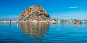
Morro Rock. Photo by Dennis LeBlanc, outdoorproject.com.
The BLM plan would open 1,222 acres of federally-owned mineral estate within Montana de Oro State Park, a coastal park popular with hikers, mountain bikers, equestrians, campers, and beach visitors. A 200-acre parcel overlapping much of Reservoir Canyon Natural Reserve, where BLM mineral rights underlie a popular loop trail with panoramic views of the San Luis Obispo and the Santa Lucia Mountains, could be opened to drilling and fracking. The plan would also open a 76-acre BLM-owned directly adjacent to the Irish Hills Natural Reserve, a 720- acre open space administered by the City of San Luis Obispo with many popular trails. Additionally, the BLM plan could allow drilling and fracking atop and surrounding Morro Rock, a volcanic plug at the entrance to Morro Bay Harbor. It is protected as the Morro Rock State Preserve and is a State Historic Landmark.
The Carrizo Plains Ecological Reserve is a 38,900-acre wildlife preserve that connects the Los Padres National Forest to the Carrizo Plain National Monument, and is owned and managed by the California Department of Fish & Wildlife. However, BLM owns portions of the mineral rights underlying the area. The BLM plan would open nearly one-third of the reserve (12,802 acres) to oil drilling and fracking, threatening several endangered species along with native grasslands, vernal pools, and reintroduced populations of tule elk and pronghorn antelope. Several hiking and equestrian trails pass through the lands slated for drilling.
Several parcels between Los Alamos and Lompoc in the Purisima Hills, including 4 parcels totaling 160 acres owned by the Rancho Santa Rita Preserve, part of the state-and federally-approved La Purisima Conservation Bank, could be opened under the plan. The 853-acre bank — the first of its kind in Santa Barbara County — provides a mechanism for developers and agencies to mitigate their impacts by purchasing mitigation credits at the property. The conservation bank contains a healthy population of endangered California tiger salamanders. A large 3,100-acre parcel of mineral estate within Lompoc and directly below Ken Adam Park — a 42-acre park featuring large group picnic area, a children’s playground, individual picnic areas, horseshoes, volleyball, nature trails, six primitive RV campsites, restroom facilities, and open space — would be opened to drilling and fracking under the BLM plan as well.
The study could open several key parcels in Ventura County to drilling and fracking, including the Ojai Valley Land Conservancy’s Ilvento Preserve. This 80-acre parcel was the first land acquisition for OVLC, donated by the Ilvento Family in 1997. Located on a ridge near The Thacher School in the east end of Ojai Valley, the Preserve is host to diverse native plant communities and important wildlife corridors. The parcel is open to the public and features breathtaking views of the Ojai and Upper Ojai valleys, Topa Topa Bluffs, and Chief Peak.
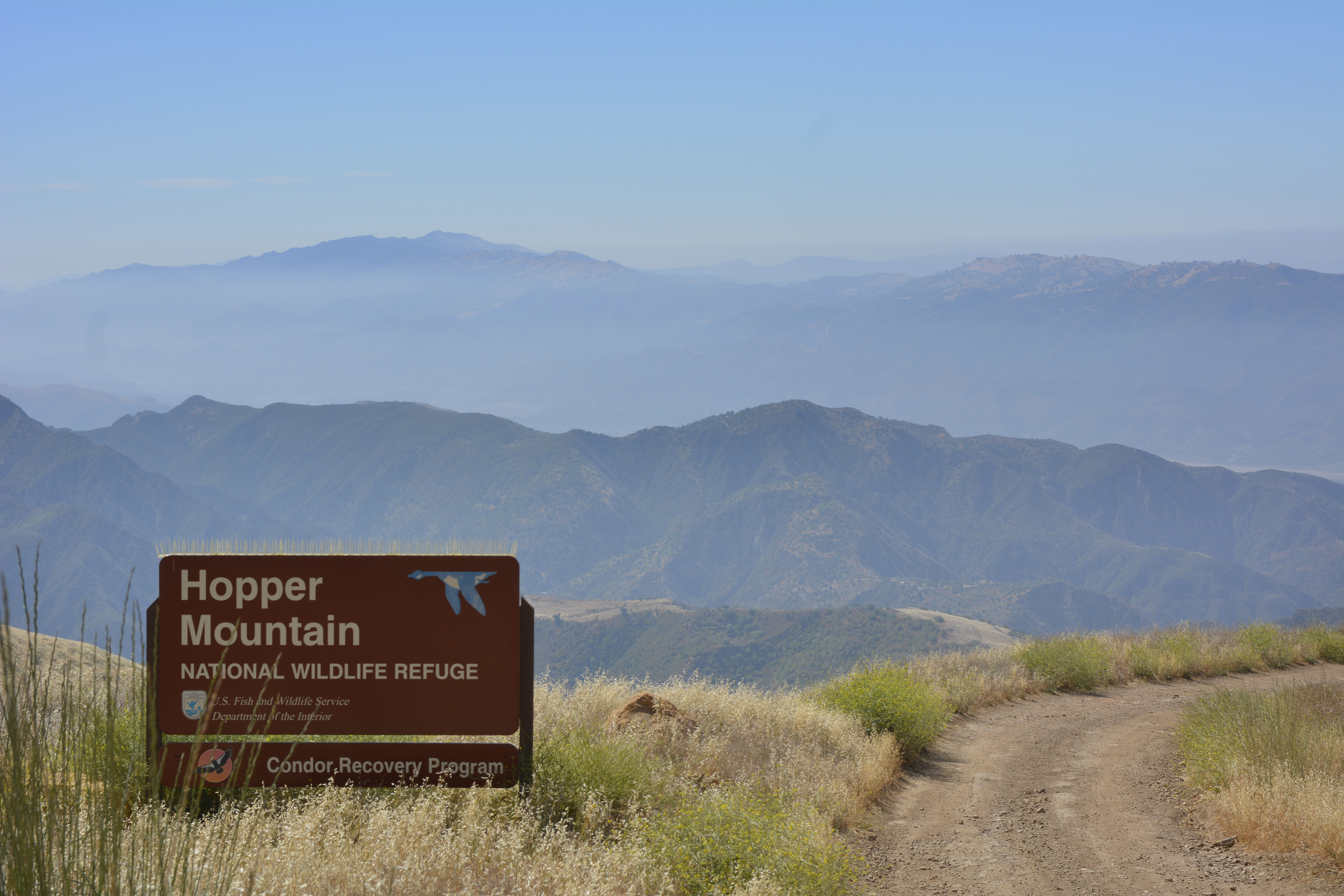
Several parcels adjacent to the Hopper Mountain National Wildlife Refuge would be opened to drilling and fracking. Photo by Jon Myatt/USFWS.
Other areas in the county that the BLM’s plan opens for drilling and fracking include nearly 1,500 acres of federal public land adjacent to and within one mile of the Hopper Mountain National Wildlife Refuge, which serves as the hub for efforts to reintroduce endangered California condors into the wild. Also opened to drilling and fracking are several parcels between Fillmore and Piru, a scattering of parcels on the ridge separating Lake Casitas from Highway 101 along the coast, several parcels in the hillsides behind the City of Ventura, and a small parcel on Boney Mountain in Point Mugu State Park.
While the BLM’s plan does not address drilling and fracking inside the Carrizo Plain National Monument (that area has its own separate management plan), it would allow drilling and fracking across 15,338 acres directly adjacent to the monument’s eastern boundary in the Temblor Mountains.
Streams and Reservoirs
The BLM plan would open a 4-acre parcel on the shore of Lopez Lake near the Dune Vista Trail, along with another 320 acres on a hillside a half-mile away that drains directly into the lake. These are mostly state-owned lands with BLM sub-surface mineral estate. The lake provides clean drinking water to the Five Cities and includes a popular recreation area administered by San Luis Obispo County Parks offering camping, fishing, boating, picnicking, hiking and equestrian trails, mountain biking, zip-lining, and birdwatching.
The BLM plan opens more than 32,000 acres of parcels in the Santa Lucia Mountains between Highway 46 and the SLO-Monterey county line, including hundreds of acres surrounding Lake Nacimiento. Some of these parcels are visible along Highway 1 near Pine Top Mountain at the gateway to the Big Sur coastline.
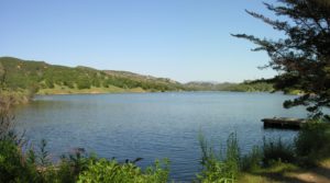
Santa Margarita Lake in SLO County.
The BLM plan would open scattered parcels in the area bounded by Santa Margarita, Highway 58, and Santa Margarita Lake totaling more than 5,000 acres of mostly BLM-owned land. It includes several large parcels bordering and emptying into Santa Margarita Lake, which provides clean drinking water for the City of San Luis Obispo along with numerous outdoor recreation opportunities. The BLM plan would open more than 7,000 acres to drilling and fracking on BLM land in the La Panza Mountain Range along the San Juan River.
The BLM plan opens 980 acres of BLM land upstream from Whale Rock Reservoir and adjacent to the Los Padres National Forest. Whale Rock Reservoir serves as a source of clean drinking water for the City of San Luis Obispo and the Cal Poly campus. The City and the California Conservation Corps have also embarked on a multi-year effort here to eradicate invasive fish from the reservoir and restore steelhead that historically spawned in the area. The reservoir is popular with hikers, anglers, picnicking families, and bird watchers who flock to the area to view the reservoir’s resident bald eagles, osprey, and migratory birds.
A 40-acre Bureau of Reclamation parcel on the north side of Lake Cachuma near Happy Canyon Road, adjacent to the Los Padres National Forest. Two small Bureau of Reclamation parcels (20 acres total) near Lake Cachuma along Highway 154, a California Scenic Highway.
Areas Around National Forest
The plan would open nearly 2,500 acres in the Huasna Valley and surrounding foothills to drilling and fracking. Included among them are several parcels alongside Huasna Road, one of the key gateways into the Los Padres National Forest.
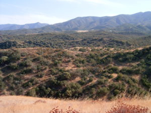
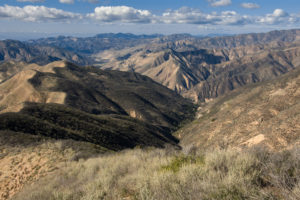
One of the areas that could be opened to drilling and fracking near the Sierra Madre Mountains.
Two BLM parcels along the crest of the Santa Ynez Mountains — one on the north face of Bald Mountain and the other in the headwaters of Nojoqui Creek near Nojoqui Falls County Park — and directly adjacent to the Los Padres National Forest would be opened to drilling and fracking under the plan. Several BLM parcels totaling 1,793 acres in a rural, remote canyon east of Santa Maria, would also be opened under the plan. One of the largest parcels straddles Colson Canyon Road, one of the few gateways into the Los Padres National Forest in northern Santa Barbara County.
Approximately 13,375 acres along the foothills of the Sierra Madre Mountains in the Cuyama Valley, most of which are adjacent to national forest lands proposed for wilderness protection under the Central Coast Heritage Protection Act introduced in the House and Senate earlier this year, could be opened to drilling and fracking under the plan as well. Two of these areas are major gateways into the Los Padres National Forest — Santa Barbara Canyon and Bates Canyon. Both have publicly-accessibly trailheads and roads leading into the Los Padres National Forest.
A third privately-owned 40-acre parcel is located between Sisar Canyon and Koenigstein Road in Upper Ojai.
Existing and Proposed Wilderness
The plan would open 480 acres of private land immediately adjacent to the Machesna Mountain Wilderness in the Los Padres National Forest. The wilderness area was established by Congress in 1984.
San Rafael Wilderness near the parcels that could be opened up to drilling and fracking.
Several parcels totaling 1,766 acres inside the national forest boundary near the Sisquoc River, including one parcel adjacent to the San Rafael Wilderness and another parcel straddling the Sisquoc River, which is critical habitat for endangered steelhead.
The plan also identifies nearly 660 acres of mineral estate beneath lands owned by the BLM that are proposed for wilderness protection under the Central Coast Heritage Protection Act that could be opened to drilling and fracking. An additional 5,580 acres directly adjacent to proposed additions to the Dick Smith, Machesna Mountain, San Rafael, and Santa Lucia Wildernesses under the Act could be opened to oil development as part of the plan.
Military Bases
The BLM plan would open more than 43,000 acres of Camp Roberts, a California National Guard post where units train annually. The national guard also opens these vast lands to the public for hunting and fishing opportunities.
Vandenberg Air Force Base – 102,650 acres — nearly the entire base — is slated as “open” for drilling.
The BLM plan would also open up to drilling and fracking three properties that comprise the Naval Base Ventura County: the Port Hueneme Naval CBC, the Pt. Mugu Naval Base, and all of San Nicolas Island (one of the eight Channel Islands located offshore Ventura County).


Comments are closed.