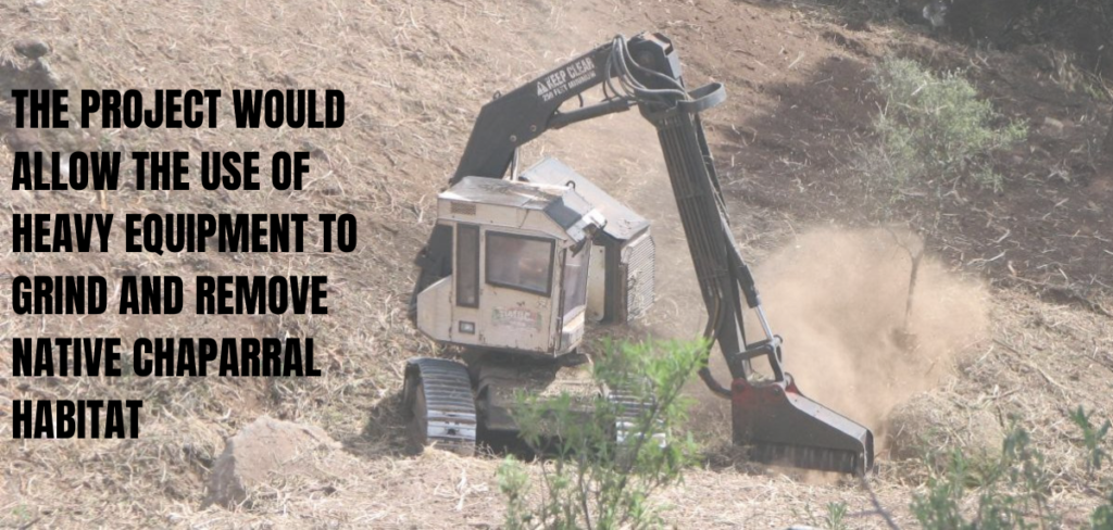
More than 3,000 people and 100 organizations have voiced opposition to a U.S. Forest Service plan to log trees and clear vegetation across enormous swaths of Los Padres National Forest. The extreme plan would cause the needless destruction of more than 235,000 acres of land—that’s the size of 3.76 million tennis courts or 178,400 football fields. It’s by far the largest project ever proposed here.
The opposition—the most diverse and widespread in the history of this national forest—emerged during a recent public comment period for the plan. Concerns included the plan’s impacts to the environment, tribal sacred sites, trails, and camps. Many commenters called on the Forest Service to prepare a robust and detailed Environmental Impact Statement (EIS), and to return to the drawing board to develop a smaller, more reasonable and scientifically defensible plan.
In one letter, 81 organizations joined together to call on Forest Supervisor Chris Stubbs to reconsider the plan. “It is imperative that the U.S. Forest Service conducts an appropriate level of environmental review for a project of such immense scale and scope, and the best available science must be incorporated into this decision-making process. More prudent would be an approach that first goes back to the drawing board given the numerous flaws with the current proposal.”
That letter was signed by some of the region’s top environmental organizations including ForestWatch, Channel Islands Restoration, Community Environmental Council, Environmental Defense Center, Gaviota Coast Conservancy, Greenspace – The Cambria Land Trust, Keep Sespe Wild, North County Watch, Quail Springs, Sage Trail Alliance, Santa Barbara Botanic Garden, Santa Barbara Channelkeeper, Santa Barbara Museum of Natural History, Santa Ynez Valley Community Action Alliance, Ventana Wilderness Alliance, Ventura Coastkeeper, Ventura Land Trust, and several local Audubon Society and Sierra Club chapters as well as outdoor apparel company Patagonia.
Statewide and national groups also joined the opposition letter including American Alpine Club, American Bird Conservancy, Center for Biological Diversity, Firefighters United for Safety Ethics & Ecology, Forest Carbon Coalition, Hispanic Access Foundation, John Muir Project of Earth Island Institute, Latino Outdoors, Mountain Lion Foundation, Pacific Crest Trail Association, Runners for Public Lands, Western Watersheds Project, Wild Nature Institute, WIldEarth Guardians, and Wilderness Watch.
Tribes and indigenous organizations also weighed in, including the Barbareno Ventureno Band of Mission Indians, the Coastal Band of Chumash Nation, and the Wishtoyo Chumash Foundation.
In a separate 84-page technical letter, ten organizations submitted a detailed legal review of the plan, arguing that the U.S. Forest Service is legally required to prepare an Environmental Impact Statement and to ensure that the project complies with other important laws designed to protect our environment and communities including the Roadless Area Conservation Rule, National Forest Management Act, Endangered Species Act, and Migratory Bird Treaty Act. The letter also outlined three alternative courses of action that the Forest Service should consider to reduce the project footprint, minimize impacts, and improve effectiveness. ForestWatch authored this letter with legal support from Environmental Defense Center, and was joined by Center for Biological Diversity, John Muir Project, Santa Ynez Valley Community Action Alliance, California Chaparral Institute, Santa Barbara County Action Network, Sierra Club, and Patagonia.
Several other organizations submitted concerns about the plan, including California Native Plant Society, California Wilderness Coalition, The Wilderness Society, and the Land Trust for Santa Barbara County.
The California Coastal Commission—a state agency charged with protecting coastal areas—similarly weighed in, identifying several areas of concern and requesting that the U.S. Forest Service prepare an EIS. “Fuel breaks are proposed to be as wide as 1500 feet in forested areas and 300 feet in chaparral habitat,” wrote the Commission’s Deputy Director of Statewide Planning. “Fuel breaks of this size may result in large areas of cleared vegetation that is harmful to habitat integrity, opens up large areas of habitat to edge effects, has the potential to adversely impact sensitive species and habitats, is unsightly to park-goers, and potentially results in areas of invasive annual plants that may be contrary to wildfire containment.” The Coastal Commission also recommended that the U.S. Forest Service coordinate with state agencies, tribes, and communities, avoid clearing and logging in remote areas, and focus on more effective wildfire mitigation actions such as defensible space close to homes, structural hardening, and other community-focused efforts.
As of today, no organizations or other entities have publicly announced their support for the project, with the exception of the Coalition of Labor, Agriculture, and Business, a radical lobbying organization that consistently takes extreme positions against environmental protection. The assessment is funded by Pacific Gas & Electric, an investor-owned utility responsible for some of the state’s largest and deadliest wildfires. PG&E is currently facing criminal charges for its role in a 2020 wildfire in Northern California.
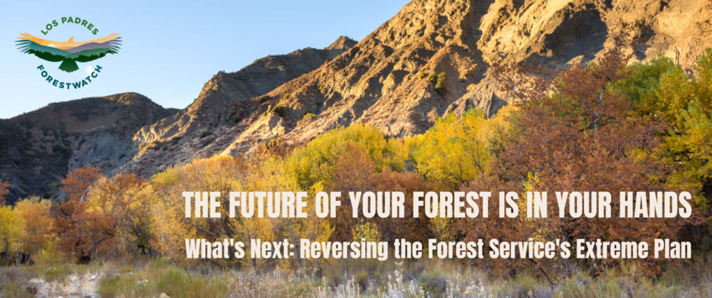
What’s Next
The U.S. Forest Service does not seem phased by the widespread opposition and still intends to move forward with the preparation of a less-detailed Environmental Assessment. That draft document is scheduled for public release in March 2023, and the public will have an opportunity to review and comment on it. Officials hope to approve the plan in October 2023.
ForestWatch and our allies will continue to build community opposition to the plan, educate the public, and work to convince forest officials to change course. We have filed a series of requests under the Freedom of Information Act, but so far the U.S. Forest Service is dragging its feet and refusing to provide us with many public records regarding the plan.
How You Can Help
- Submit a comment: If you’ve already submitted your comments to forest officials, great! Thank you. If you haven’t gotten around to it yet, it’s not too late. Even though the initial “scoping” comment period is over, your comments will still be reviewed and considered. Click here to quickly dispatch an email to the Forest Service. Your voice matters.
- Visit ProtectYourForest.org: Read more about the plan, explore the interactive map, learn about better ways to protect our communities, and view a list of organizations that are working together to make a difference.
- Donate to the Forest Defense Fund: Contributions of any size, large or small, will give us the resources we need to keep the momentum going.
- Organizations and businesses: Do you own a local business or officially represent a community organization? If so, join the growing list of organizations that are demanding a better way. We are stronger together!


Comments are closed.