Our Rivers & Watersheds Program
ForestWatch recognizes the importance of clean water to our communities, economy, and aquatic habitat. We monitor stream conditions, track pollutants to their sources, and work to stop further impairment of our waterways. We work with the Forest Service to restore degraded areas and ensure that activities use “best management practices” to reduce or eliminate water pollution.
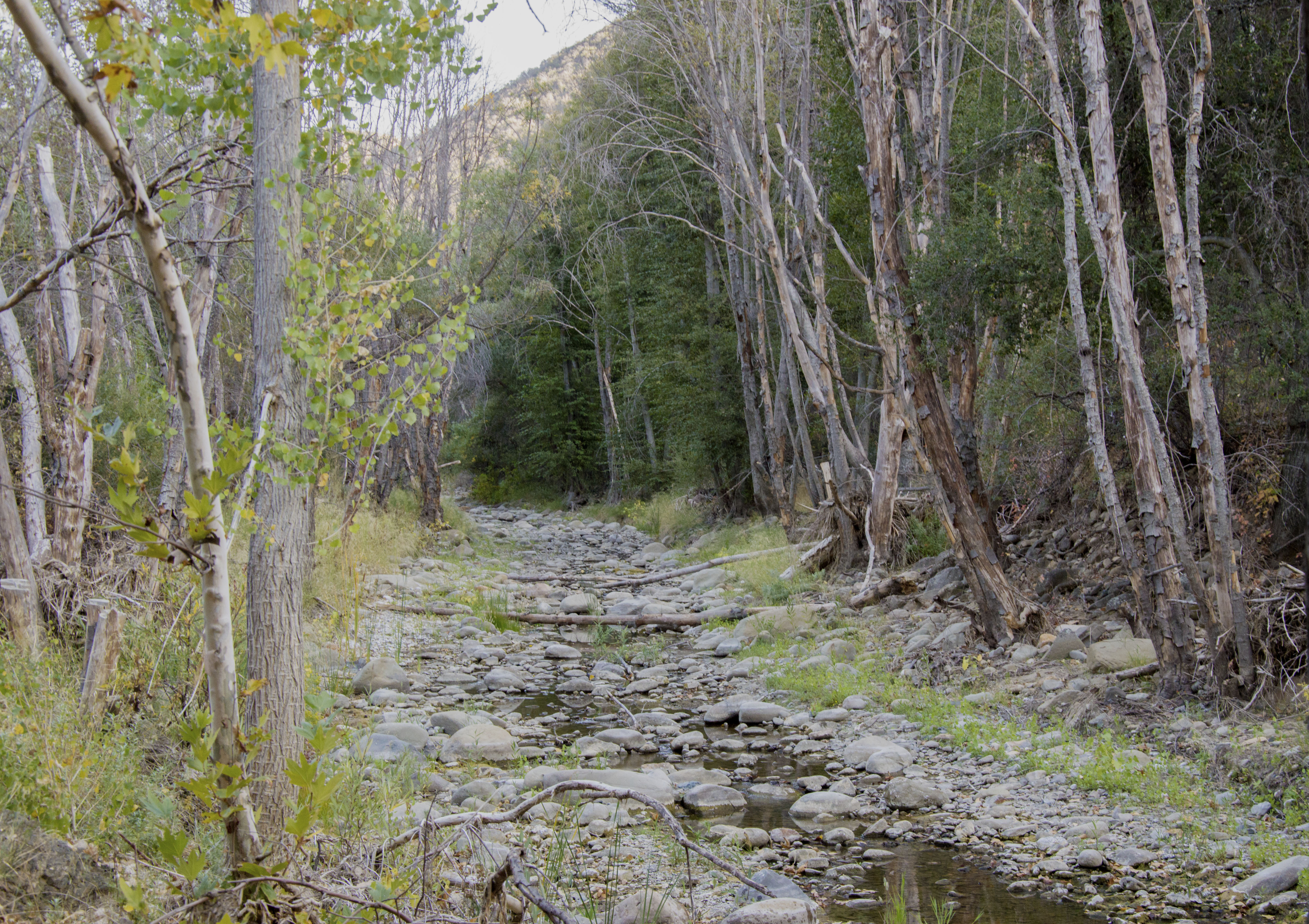
Manzana Creek, a tributary to the Sisquoc River in the Los Padres National Forest. Photo by Bryant Baker.
ForestWatch also monitors the forest’s riparian areas and works to defend these last remaining riparian habitats from the harmful effects of dams, water diversions, off-road vehicles, overgrazing, mining, and invasive species.
Additionally, ForestWatch advocates for the removal of defunct dams that harm ecosystems and no longer serve their original purpose. We track the relicensing process for all dams on the Los Padres, and work to ensure that all license renewals incorporate maximum protections for riparian and aquatic habitats and species. In addition, we monitor current dam operations and work to reduce or eliminate the impacts of dams on our water resources.
Rivers and Watersheds of the Los Padres
The Los Padres National Forest was originally established to protect the pristine water sources for the coastal communities surrounding the forest. Today, the Los Padres encompasses 1,134 miles of rivers and streams, providing water for urban and agricultural use, habitat for rare and at-risk species, and exciting recreation opportunities. Healthy and free-flowing waterways are a vital part of this landscape.
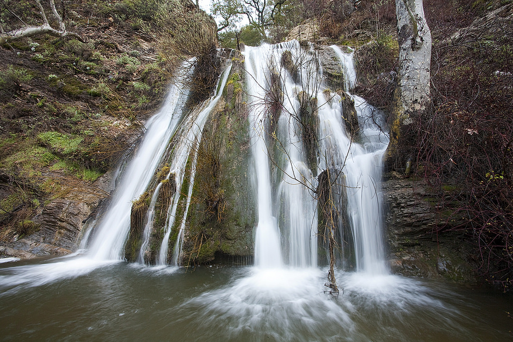
The Arroyo Grande Creek watershed’s Big Falls found within the Santa Lucia Wilderness in the Los Padres National Forest. Photo by Bill Bouton
The major waterways in the forest are the Ventura and Santa Clara Rivers in Ventura County; the Santa Ynez River in Santa Barbara County; the Cuyama and Salinas rivers in San Luis Obispo County; and the Carmel River in Monterey County. In addition, Congress has designated 84 miles of “wild and scenic” rivers, including the Sespe, Sisquoc, and Big Sur rivers.
ForestWatch works to protect water quality, ensure adequate water supplies, and preserve riparian habitat in these and all of the 35 watersheds of the Los Padres. Our Rivers and Watersheds Program focuses on water quality, riparian habitat, wild and scenic rivers, dams, and water supply.
Water Quality
The Los Padres provides the major source of water for 37 reservoirs within and near the national forest, providing water for central coast towns and a rich variety of agricultural crops. While most of these waterways remain in good condition, several others are becoming increasingly impaired and polluted. In fact, the Forest Service admits that nearly half (17) of the watersheds in the Los Padres are in “moderate” or “poor” condition.
Water pollution spells significant problems for communities, agriculture, tourism, recreation, and habitat. Several communities – Santa Barbara, Ventura, Carmel, Monterey, Ojai, Arroyo Grande, and others – receive their drinking water from rivers that originate in the Los Padres. Many watersheds within the Los Padres drain directly into the Pacific Ocean, including the Monterey Bay National Marine Sanctuary.
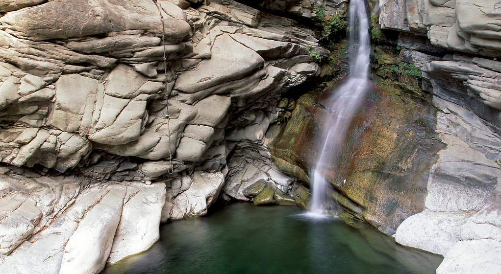
A popular swimming hole along Santa Paula Creek in the Los Padres National Forest. Photo courtesy Tim Hauf.
Roads are the main source of water pollution in the Los Padres, causing increased sedimentation and erosion. Other activities that impact water quality include grazing, mining, fuels management, and oil drilling. As a result of these activities, at least 10 streams classified as “impaired” by the U.S. Environmental Protection Agency originate in, or flow through, the national forest. Despite recurring water quality problems in several areas, the Forest Service devotes only 8% of its resource management budget on protecting water quality.
Riparian Habitat
The Los Padres contains 19,000 acres of riparian (streamside) habitat. Channelization and diversion of streams in the last century have reduced riparian habitats in southern California by over 90%. Habitat loss is particularly extensive along lower-elevation streams (those below 3,000 feet elevation), and as a result, these areas have a much higher number of threatened, endangered, and sensitive species.
The Los Padres plays an important role in preserving these rare habitats. It contains 60% of the most significant low-elevation streams in southern and central California. The Sisquoc River has been dubbed the “most pristine stream in southern California,” and other streams of high ecological integrity include the Sespe, Mono, Indian, Upper Santa Ynez River, Piru Creek, Upper Cuyama River region, Big Sur River, Little Sur River, and San Carpoforo Creek.
Wild & Scenic Rivers
Recognizing the magnificent character of freeflowing rivers in the Los Padres, the U.S. Congress has designated 84 miles of Wild & Scenic Rivers within its boundaries. These include the Big Sur, Sisquoc, and Sespe. The Forest Service was recently sued for failing to create management plans for these rivers, as required by the Wild & Scenic Rivers Act. Eleven years later, in 2003, these plans finally took effect, and ForestWatch will ensure that the agency implements and enforces them.
The Los Padres contains an additional 288.5 miles of rivers eligible for future protection under the Wild & Scenic Rivers Act. For the last several years, the Forest Service has studied the following waterways for inclusion into the wild and scenic river system: Arroyo Seco and Little Sur rivers; and Piru, Lopez, Matilija, and Upper Sespe creeks. ForestWatch believes that it is time for the Forest Service to finally take action, and works to gain lasting protection for all of these majestic rivers.

San Clemente Dam on the Carmel River in the Monterey Ranger District of the Los Padres National Forest. Photo courtesy sanclementedamremoval.org/
Dams
There are more than 1,400 dams in the state of California, along with several thousand miles of levees, channels, and canals. This complex hydrological system provides significant benefits in terms of water supply, power generation, flood control, and reservoir-based recreation. But it also has environmentally damaging consequences. Dams have caused 67% of California’s native fish species to become extinct or decline to dangerously low levels. Dams harm aquatic ecosystems and degrade water quality by altering flows, modifying water temperatures, inundating habitat, and blocking the movement of species, nutrients, and sediment. Today, very few steelhead are able to migrate beyond Bradbury, Gibraltar, and Jamison dams to access prime habitat in the Upper Santa Ynez River and its tributaries. The Santa Ynez River was once the region’s prime steelhead fishery, but today only supports a few hundred migrating steelhead.
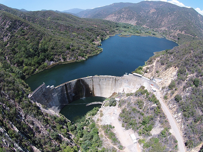
Aerial view of the Matilija Dam. Photo by Ventura County Watershed Protection District.
Most of the major rivers on the Los Padres are dammed. Many of these reservoirs provide important water supplies to nearby communiti Others – like the Matilija Dam on the Ventura River – have become filled with sediment and are no longer useful. Several organizations and agencies are working on a plan to remove the Matilija Dam, returning that river to its freeflowing state. ForestWatch advocates for the removal of defunct dams that harm ecosystems, block fish passage, and no longer serve their original purpose.
Dams are licensed by the federal Bureau of Reclamation. The licenses for several dams in the Los Padres are coming up for renewal in the next few years. ForestWatch works to ensure that any license renewals incorporate maximum protections for riparian and aquatic habitats and species. In addition, we monitor current dam operations and work to reduce or eliminate the impacts of dams on our water resources.
Water Supply
Most waterways in southern California have very low flow during the summer and fall months, and many times dry up completely until the first significant rains of the winter. Because water is so scarce in this region, the demand for freshwater greatly exceeds the natural supply.
The Los Padres provides a valuable water supply to nearby agriculture, campgrounds, and residences. There are an untold number of water diversions, impoundments, wells, pipelines, and other infrastructure that move water from rivers to where it is needed. If too much water is withdrawn from a river, the water table lowers, and water supply is reduced for habitat and for downstream water users.